
Range monitoring catches on with ranchers to document ecological conditions on public lands
Seth McFarland grew up on his family’s ranch in Carmen Creek, just north of Salmon, Idaho. Last year, he graduated from the University of Idaho with a range management degree. McFarland was eager to apply what he learned from college in managing the ranch.
He’s set up more than 10 range-monitoring transects on their private land and nearby Bureau of Land Management and Forest Service grazing allotments. Today, McFarland is recording information from a line-point intercept monitoring transect on the Badger Springs BLM allotment adjacent to their ranch.

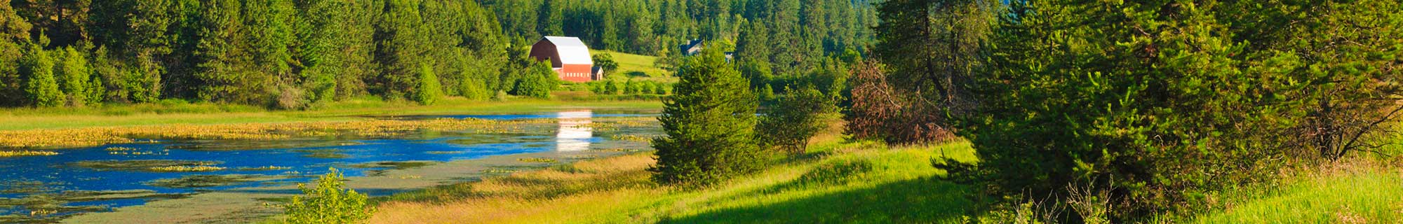
Range monitoring helps document rangeland ecological conditions over time on federal grazing allotments and on private ranchlands.
“What I do is collect cover data right at every 4 feet along this 200-foot transect,” McFarland says. “The cover data will indicate long-term trend. And I will repeat this every 4-5 years.”
At the monitoring points, McFarland is finding native bluebunch wheatgrass, Idaho fescue, wildflowers and sage brush, among other species. His Dad found a grouse nest under a sage brush a few feet away.
“The line point intercept is essentially like an inventory,” McFarland says. “So this method is just a rapid quick assessment, a quick inventory of what’s here, and it’s useful for trend over time.”
Range monitoring is becoming more important as ranchers realize the need to track ecological conditions on private and public rangelands. Rancher Tom McFarland is happy to see his son return from college with the knowledge of how to monitor rangelands with scientific integrity.
“We knew we needed it,” says Tom McFarland, Seth’s father. “You’re always going to put your camera in the saddle bag and take some pictures but somehow, you didn’t do that. He’s the tool, the asset we needed to get that done.”

Seth McFarland uses a previous monitoring photo to help him find the same photo point he used previously. Here, he’s documenting ecological conditions in a meadow along Carmen Creek on the McFarland Ranch. The family’s objectives for the meadow are to improve wildlife habitat and create forage for fall livestock grazing.
“If we’re going to keep ourselves on federal lands, we need to manage it in such a fashion that ecologically it’s sound for everything else out there, the wildlife, the fish, all of those other critters, and I think the monitoring is going to give us the basis, the real tool, to be able to do that and show that we are good stewards of the land,” Tom McFarland said.
This year, the University of Idaho, the Idaho Cattle Association and the Idaho Rangeland Resource Commission co-sponsored range-monitoring workshops so ranchers can learn the proper techniques for tracking range conditions.
In a workshop in McCall, ranchers learned how to set up photo-monitoring points in riparian and upland areas. Amanda Gearhardt, the workshop leader, pointed out in a classroom session that photo monitoring is:
- Easy to set up
- The photos taken can be added to range- condition data kept by federal agencies
- Photos will complement other monitoring data
- Plus, the pictures tell a story about the land over time.
In the Fish Creek meadows area, ranchers broke into teams to set up photo monitoring points in a riparian area. We followed the “Pam” group with Pam Schwenkfelder, a Cambridge rancher.
The first question our group had was: How do you decide where to locate the photo-monitoring point?
Amanda Gearhardt helped the group decide on the location. “What’s going to show change out here? What are you going to try to influence with your management out here?” she asked.
Holly Hampton, a range conservationist for the Boise National Forest, gave some additional guidance. “For example, on a creek if our goal is a stream temperature issue … maybe we want to affect the shade, so we could shoot to get more willows on it?”

Monitoring on riparian areas can include before and after photos to show the regrowth of woody vegetation such as willows and other riparian plants over time.
“So maybe there’s two goals here,” Gearhardt said. “We want to see what our cows are eating, and we want to see what the temperature of the stream is. So we take two pictures. Awesome, good job!
Pam Schwenkfelder takes a photo looking downstream and upstream from the photo point in the Fish Creek meadow. The white board indicates the location and the date. The GPS coordinates of the monitoring location are logged for future reference. This can be done with a smart phone or GPS unit. And the location should be marked as well with a stake or something that’s easily found in the field.

Amanda Gearhardt pounds a range monitoring marker into the ground for easy reference to find the photo point in the future. It’s also helpful to GPS the location and keep that information for future reference.
Experts recommend that ranchers should take notes on plant species, weather conditions and other helpful information to supplement the photo data. “Write the main stuff down. If you did a stream bank, you’d probably want to say, was it bare? Is it stable, is it eroding, getting more stable?” said Karen Launchbaugh, a workshop leader and professor of range science for the University of Idaho.
Next, the group heads up the hill to set up a monitoring point on an upland site. Rancher Jason Anderson sets up the white board information with the date and location. Holly Hampton points out that it’s helpful to include natural landmarks in photos.
“As far as the photo point itself, you’re probably going to want to do it so you can find it again in 10 years,” she says. “Look for landmarks in the photo that you can use to line up the photo in the right spot.”
Pam reconfigures her position and gets the shot. Ranchers said the tips on photo-monitoring were helpful.
Said Jason Anderson, a Twin Falls rancher, “It’s pretty awesome to monitor, it’s important not only for me in my experience, it would have been nice to have my grandfather or my dad do it, too. Yeah, I learned a lot. It’s kind of like a journal, or a history, for me and my management, and future generations.”
Cambridge rancher Royce Schwenkfelder says it’s important to monitor conditions on private land as well. “We have a lot of sage-grouse habitat, and we want to show that we’re not adversely affecting sage-grouse habitat,” he said. “We spring graze that area to a standard in our range plan, and we want to stay on track with that.”
Back at the McFarland Ranch, Seth takes photo points on their private land along Carmen Creek. “We’re managing this riparian area primarily for wildlife habitat and secondarily, for livestock,” he says. “The purpose of photo monitoring here on our private land is to document the change in the stream bank. This is a relatively recent change — the stream used to be about 200 feet over to my left, and I want to document how is the stream channel changing in conjunction with a fall grazing regime.”

Seth McFarland has shown a lifelong interest in plants, wildlife and cattle ranching since he was a boy. Seth’s passion for these things led to him getting a bachelor’s degree in range ecology from the University of Idaho. He has set up monitoring transects on his family’s ranch and also works as a contractor for the BLM and Forest Service to collect range-monitoring data.
“Specifically, what species are coming in? Are we getting the sedges and rushes, the woody structure, the cottonwoods, the alders, are they coming in to stabilize the bank? and also what’s happening with the meadow?”

McFarland keeps close watch over wildlife on the ranch.
Seth hopes that range monitoring on private and public lands will ensure a long future for his family.
“We are recognizing that we, as an industry, need to have more evidence in support that we can sustainably graze these rangelands,” he says. “What I’m trying to do with monitoring is to show that we can sustainably graze these federal rangelands, it helps with our local economy, by keeping these operations sustainable, and it also shows we can maintain and progress toward overall ecological health.”

The McFarland Ranch is part of the Central Idaho Rangelands Network, a group of ranchers and conservationists who take innovative approaches to grazing, land and water management to sustain and enhance the natural and community values of the region.
Tom McFarland, meanwhile, says it’s great to have a son who’s so interested in range management. “Seth always had an intense interest in plants and the land. When other kids wanted to play sports, Seth wanted to go watch the wildlife and do things in the greater outdoors. Over time, that’s grown. He’d go collect antlers and kept dairies about what was happening out on the landscape. That’s really helped him.

Seth and Tom McFarland
Tom McFarland is a proud papa. “Oh yeah, intensely proud,” McFarland says. “He’s fortunate that he’s got that passion. Not all kids have it.”
Steve Stuebner is the writer and producer of Life on the Range, a public education project sponsored by the Idaho Rangeland Resource Commission.
© Idaho Rangeland Resources Commission, 2012